

If wetlands prevent floods and straight rivers are bad, why do we keep doing it?
Here's why, and how we can do better, along with the most AMAZING visualizations of rivers:
Here's why, and how we can do better, along with the most AMAZING visualizations of rivers:

What LA did to its river is the worst you can do: A line of concrete devoid of life, replacing nature with brutalist geometry


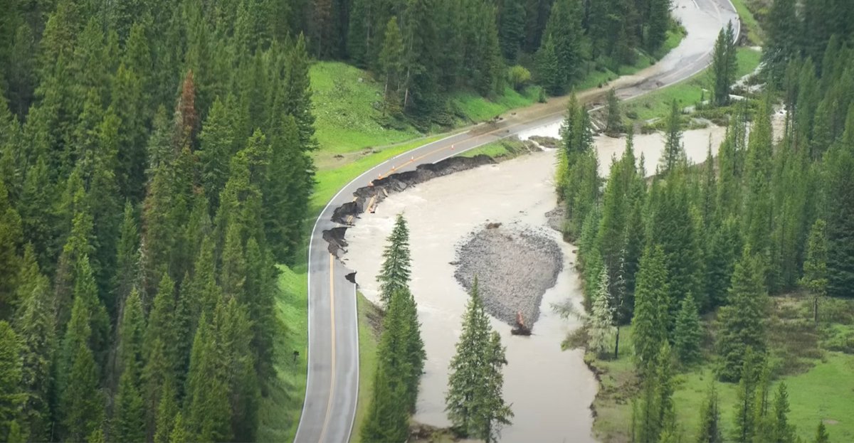
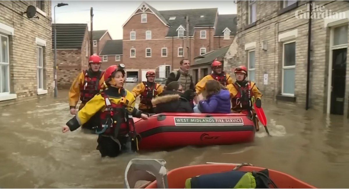
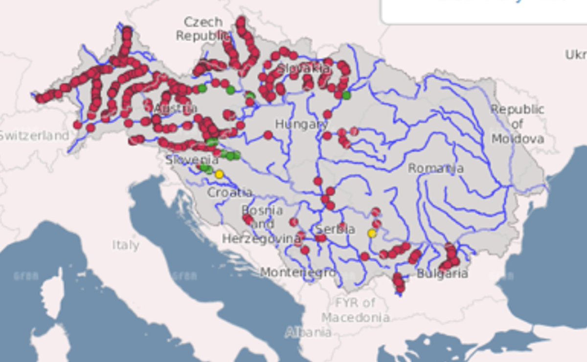
That's the type of disregard for nature that ends with situations like this one:

Because the key to understanding rivers is that they change all the time

These changes can be seen with LiDAR imagery, which shows rivers along with their floodplains: An area with present and past riverbeds
(amazing images from Dan Coe Carto)
(amazing images from Dan Coe Carto)

Sometimes, the river paths change so much that rivers take a completely different direction, like the Yellow River in China over the last 4000 years:

And why does this happen?
A small disturbance on the river's path will push water to one side
Water will move faster on the outer side➡️more erosion➡️faster water➡️more erosion
On the inner side, water will be slower➡️sandbank deposits
A small disturbance on the river's path will push water to one side
Water will move faster on the outer side➡️more erosion➡️faster water➡️more erosion
On the inner side, water will be slower➡️sandbank deposits

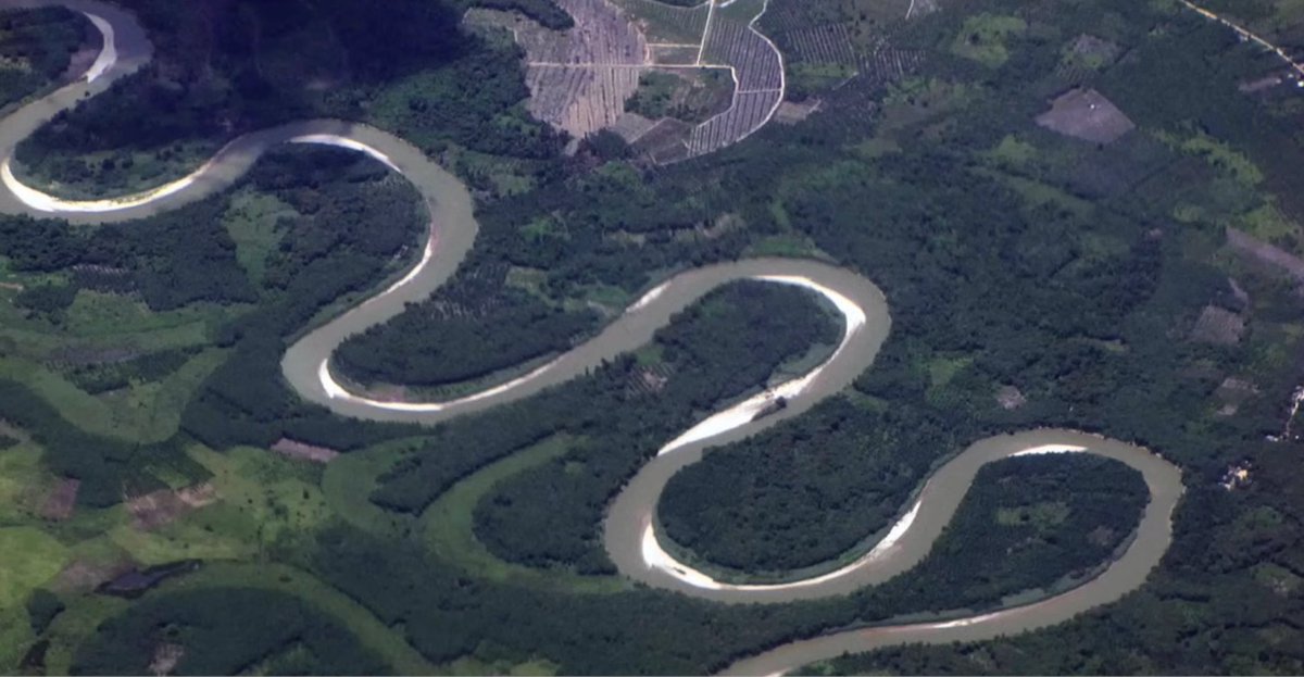
You can see this in these pictures:
• Sand banks on the internal side
• More erosion on the external side➡️meanders
That's why the house fell on the 2nd tweet: It was right on the external side of the meander
• Sand banks on the internal side
• More erosion on the external side➡️meanders
That's why the house fell on the 2nd tweet: It was right on the external side of the meander
Then one meander creates the next one, because the accelerated water of one meander smashes against the riverbanks of the next meander
(simulation from 2 Minute Earth on Youtube)
(simulation from 2 Minute Earth on Youtube)

This is why even straight, artificial rivers will immediately start meandering
Notice not just the river but also the formation of the floodplain
(simulation from the amazing @EmriverModel via Practical Engineer)
Notice not just the river but also the formation of the floodplain
(simulation from the amazing @EmriverModel via Practical Engineer)

On top of that, rivers bring sediments with them, and part deposits on the riverbed, therefore elevating the river from the surrounding plain
Very unstable!
Very unstable!

This instability means rivers move constantly, especially during floods, where they will break from their riverbed
But humans love living close to rivers because they bring water and sediments for good agriculture, and easy transportation
So they build dikes to contain rivers
But humans love living close to rivers because they bring water and sediments for good agriculture, and easy transportation
So they build dikes to contain rivers
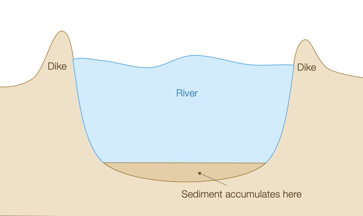
But the more dikes contain rivers, the more sediments accumulate at the bottom, and the more the river rises!
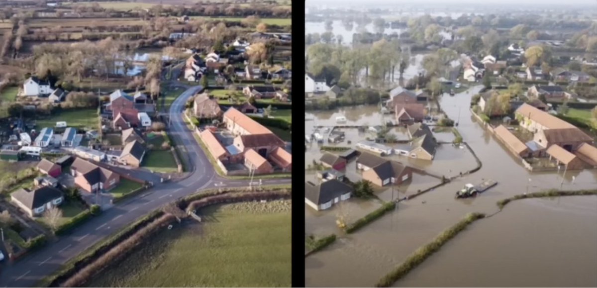
So this limits the number of floods, but not their gravity: When a flood is big enough, it breaks through the dikes and destroys everything
So this limits the number of floods, but not their gravity: When a flood is big enough, it breaks through the dikes and destroys everything

That's when you get pictures like these:
• The river has been corseted into a straight line
• No floodplain to absorb the flood
• Elevated riverbed due to sedimentation
What do we do to avoid it?
• The river has been corseted into a straight line
• No floodplain to absorb the flood
• Elevated riverbed due to sedimentation
What do we do to avoid it?
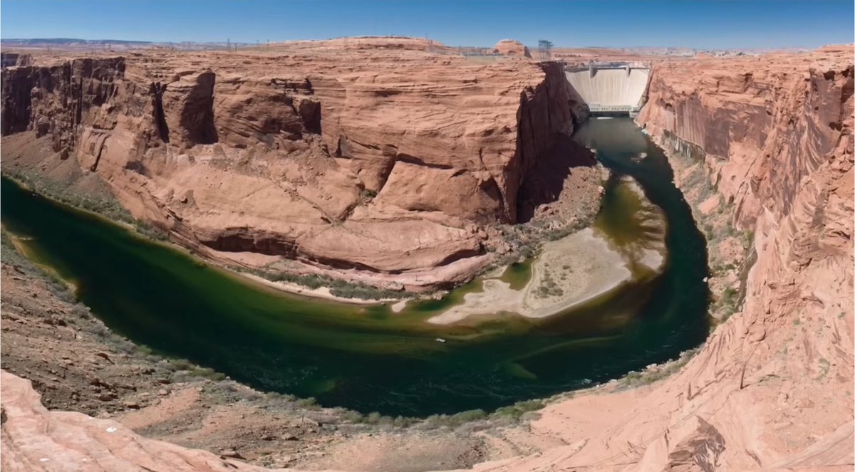
The answer is dams: By having multiple on the path of the river, each can buffer the downstream river by increasing their storage during floods and releasing it during drier times
For example, the upper Danube has dams on average every 6 km!
For example, the upper Danube has dams on average every 6 km!
But we have one more pbm: We also want rivers to be as straight as possible, because we use them for transportation—river transportation is super cheap—and straight lines are faster
That's why the Rhine had 100 km of its path shaved a century and a half ago
That's why the Rhine had 100 km of its path shaved a century and a half ago

But straighter path
➡️faster water
➡️more erosion
➡️more sediments
➡️riverbed rises faster
How do you solve this? By dredging
➡️faster water
➡️more erosion
➡️more sediments
➡️riverbed rises faster
How do you solve this? By dredging
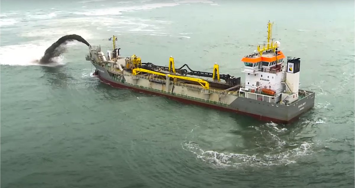
Dredging takes sediments from inconvenient parts of the river to useful ones. This cleans up sandbanks dangerous for transportation and reduces erosion
So for rivers we need for transportation:
➡️They must be straight
➡️Embankments on the side must contain it
➡️We must dredge the sediments they accumulate
➡️The bigger flood risk means we need upstream dams
➡️They must be straight
➡️Embankments on the side must contain it
➡️We must dredge the sediments they accumulate
➡️The bigger flood risk means we need upstream dams
But that's not the case for rivers we don't use for transportation! If their riverbanks have not all been claimed for habitation and agriculture, the natural floodplain can be reclaimed and rewilded. Madrid did some of that with Rio:

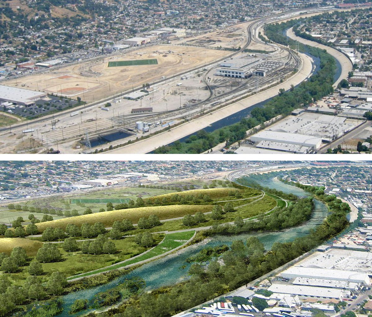
And LA is considering doing the same
Hopefully more human rivers will follow!
Hopefully more human rivers will follow!
Notice here we discussed floodplains, not wetlands
Floodplains are the natural extension that can absorb water during floods
Wetlands on the floodplains can absorb additional water. Plus they reduce erosion. We should use them when we can!
Floodplains are the natural extension that can absorb water during floods
Wetlands on the floodplains can absorb additional water. Plus they reduce erosion. We should use them when we can!

Article with many more details on this topic tomorrow. Subscribe for free to get it:
unchartedterritories.tomaspueyo.com
Next week: How the history of rivers can tell us how much governments will try to tax us!
unchartedterritories.tomaspueyo.com
Next week: How the history of rivers can tell us how much governments will try to tax us!

Loading suggestions...