

While scientists are still searching for the extinct "Saraswati" River, a possible clue lies in the Arabian Sea.
A 100 km ridge on the sea shelf, at depths ranging from 50 to 300 meters, aligns with the probable course of the mighty Saraswati River. It is believed that the Saraswati River flowed for about 15,000 years before becoming extinct. For approximately 3,000 of those years, it may have flowed through the ridge now submerged 140 meters below today's sea level.
Do we have the "will" to explore possible clues ?
*Ps : This is my personal opinion
/1

Several ancient Indian texts have provided detailed descriptions of the Saraswati river. Among these, the oldest is the Rig Veda, where the Saraswati river is described as the mightiest and the best among all rivers, despite the term "saras" actually meaning a lake.
The epic Mahabharata also mentions the Saraswati as being lost in the desert sands and then reappearing at different places in its downstream course, making it clear that the composer was aware of the Saraswati losing its flow strength.
/2
The epic Mahabharata also mentions the Saraswati as being lost in the desert sands and then reappearing at different places in its downstream course, making it clear that the composer was aware of the Saraswati losing its flow strength.
/2

There is a parallel river flowing along with Indus in map by Ptolemy (150 CE). Could this be Saraswati River ? Who knows ? More researches needed.
/3
/3

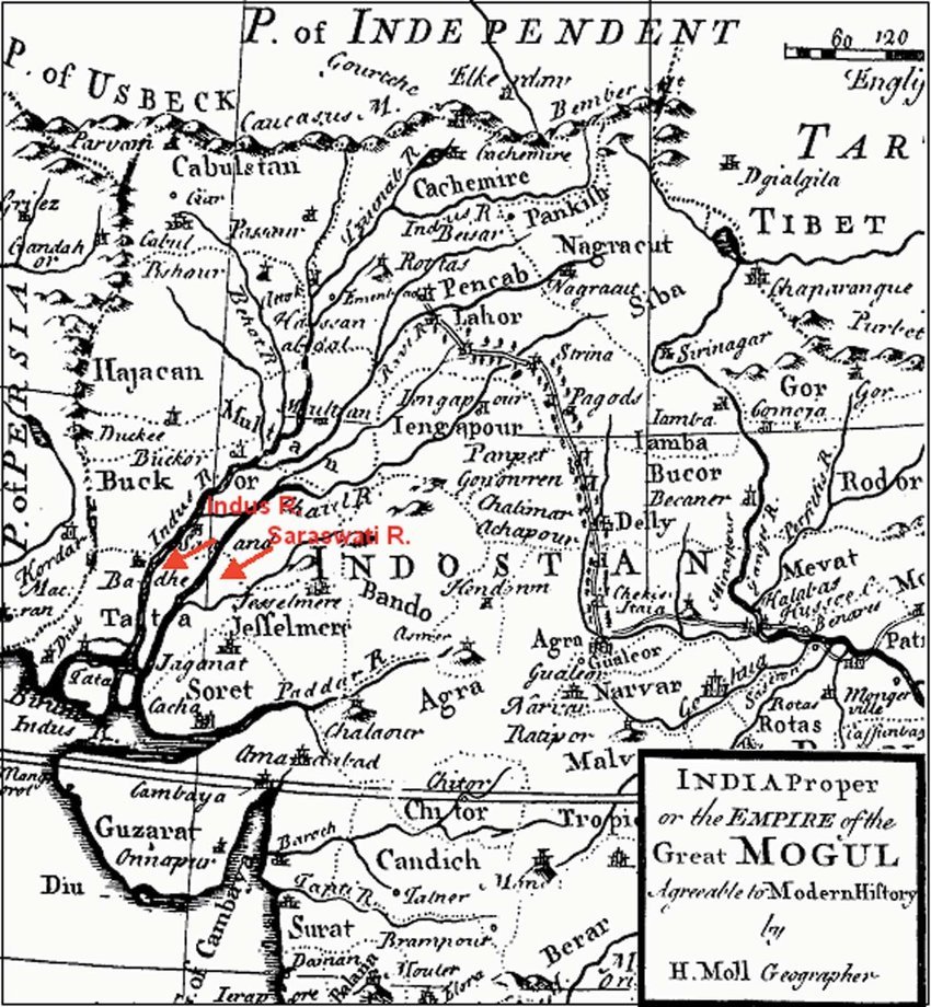
The Indus and Saraswati are shown as a parallel river system in the Mughal period map of 1746, prepared by British surveyors.
/4
/4
It was a few years later, in 1855, that French geographer Louis Vivien de Saint-Martin first specifically pointed out that the Ghaggar river was the remnant of the Rig Vedic Saraswati river. He made his derivations after studying various reports on the wide, dry river bed lying between the Sutlej and the Yamuna rivers, which were made by British topographers. That area was also exactly the location where the Rig Veda mentioned the Saraswati river to be.
Interestingly, among the various reports that Saint-Martin had studied were some old colonial maps from the 1760s that showed a small river named “Sursooty” or “Sarsuti” in that area (Michel Danino, The Lost River: On the Trail of the Saraswati, 2010).
/5
Interestingly, among the various reports that Saint-Martin had studied were some old colonial maps from the 1760s that showed a small river named “Sursooty” or “Sarsuti” in that area (Michel Danino, The Lost River: On the Trail of the Saraswati, 2010).
/5

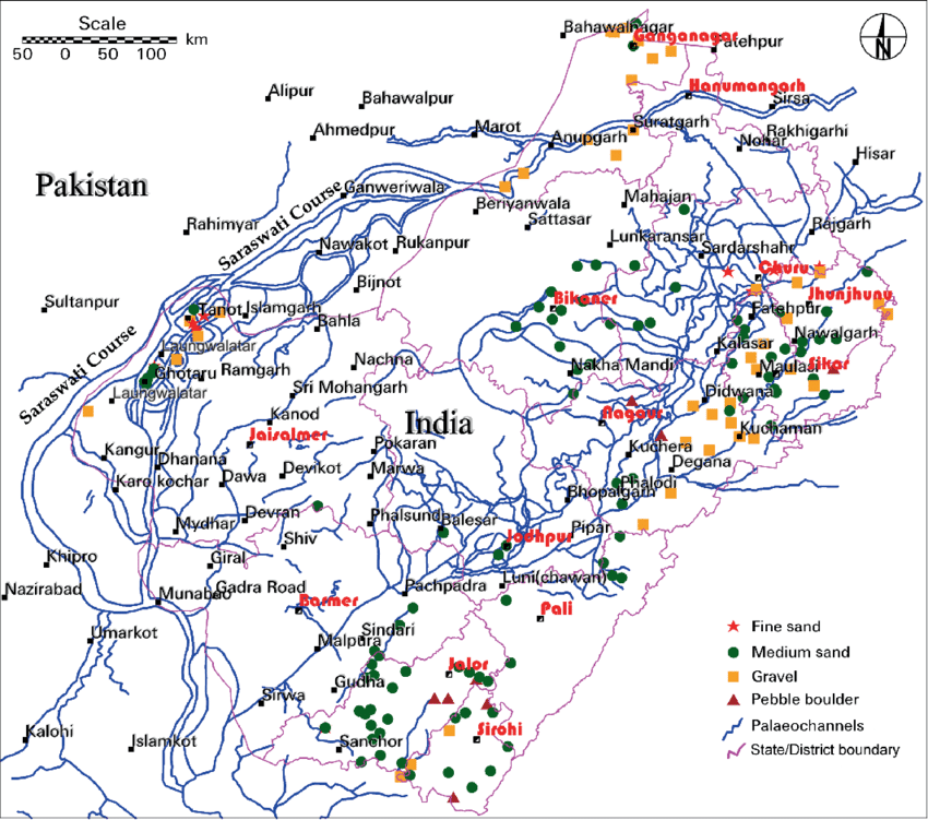
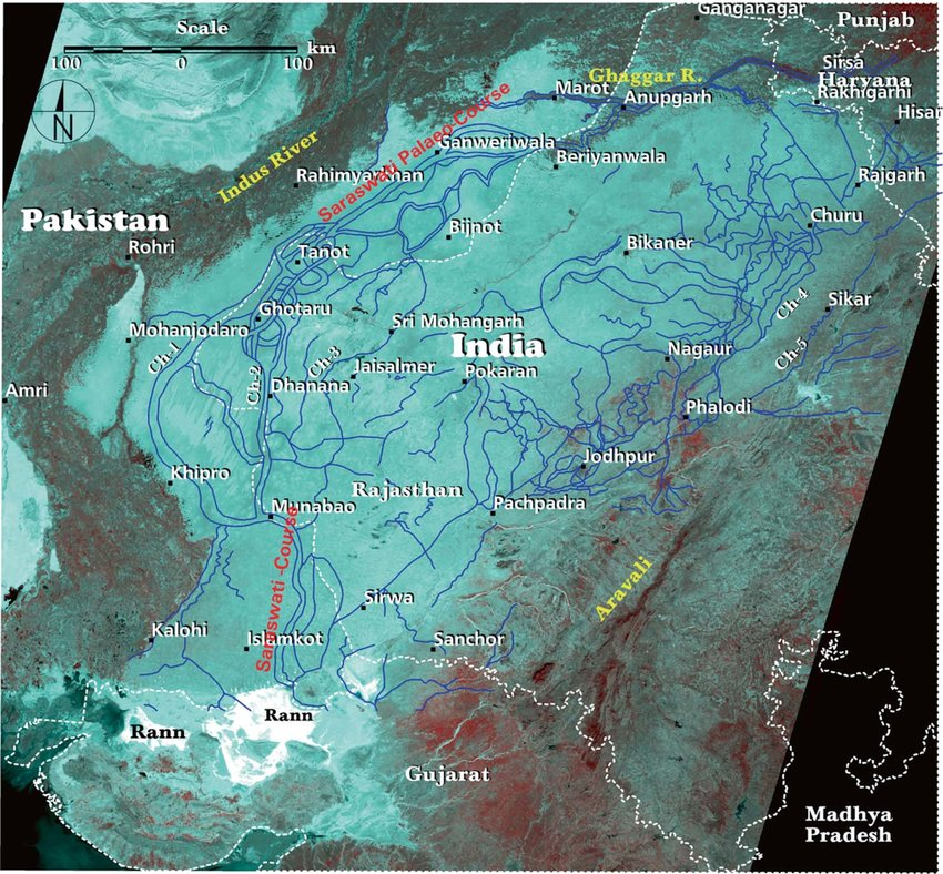
present and former streams in a.K. Johnston’s 1873 map of north india, after it was geo-referenced. Saraswati RIver is seen upto Tinot, Rajasthan
/6
/6
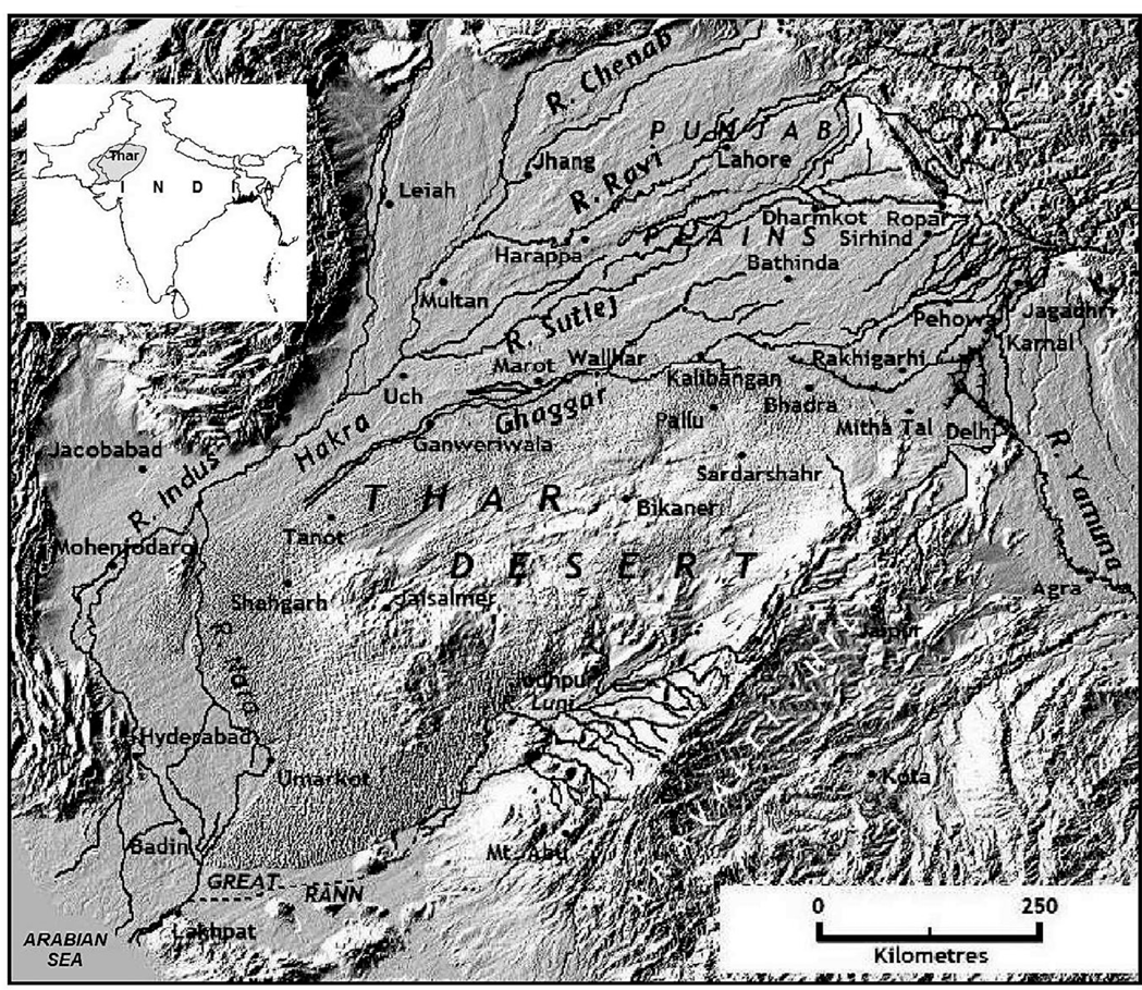
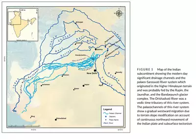
A recent study found that the Saraswati River system has two main paleo-channels. One flows through Yamunanagar, Ambala, Kurukshetra, Pehowa, Kaithal, Jind, Fatehabad, and Sirsa into Hanumangarh, Rajasthan. The other, representing the ancient Drishadwati River, passes through Yamunanagar, Karnal, Panipat, Sonepat, Jind, Hisar, and Rawatsar in Rajasthan.
A research paper revealed that six trenches (3-10m deep) were dug along 120 km of paleo-channels from Yamunanagar to Pehowa. The study, which analyzed sediment age and characteristics, found the Saraswati River flowed in Haryana from before 14±5 Ka until AD 1402, after which flow ceased abruptly, according to Prof. Chaudhari.
Harappan settlements in Haryana and Rajasthan thrived in fertile areas of the river system. Clay beds show weakened monsoons and droughts around 14,000, 6,000, and 4,000 years ago, leading to reduced river flow.
For more details, visit: [Link to article](timesofindia.indiatimes.com)
/7
During July 2024, the Ghaggar river unprecedently swell due to monsoon water.
Posted by @OfficeOfDGP on t.me
/8
Posted by @OfficeOfDGP on t.me
/8


researchgate.net/figure/The-Ind…
Figure 9. The Indus and Saraswati are shown as a parallel river system...
Download scientific diagram | The Indus and Saraswati are shown as a parallel river system in the Mu...

firstpost.com/india/decoding…
Decoding the great historical conspiracy to turn Saraswati into a mythical river
Recent scientific research, British era documentations by geologists and other experts, and our anci...
indiageomorph.org/uploads/pdf/ri…
I hope you are enjoying my contents. Please subscribe my YouTube channel @gemsofindology" target="_blank" rel="noopener" onclick="event.stopPropagation()">youtube.com and t.me and support us.
Please RT and like first tweet of this thread if you can.
/10
Please RT and like first tweet of this thread if you can.
/10

Loading suggestions...